Photos
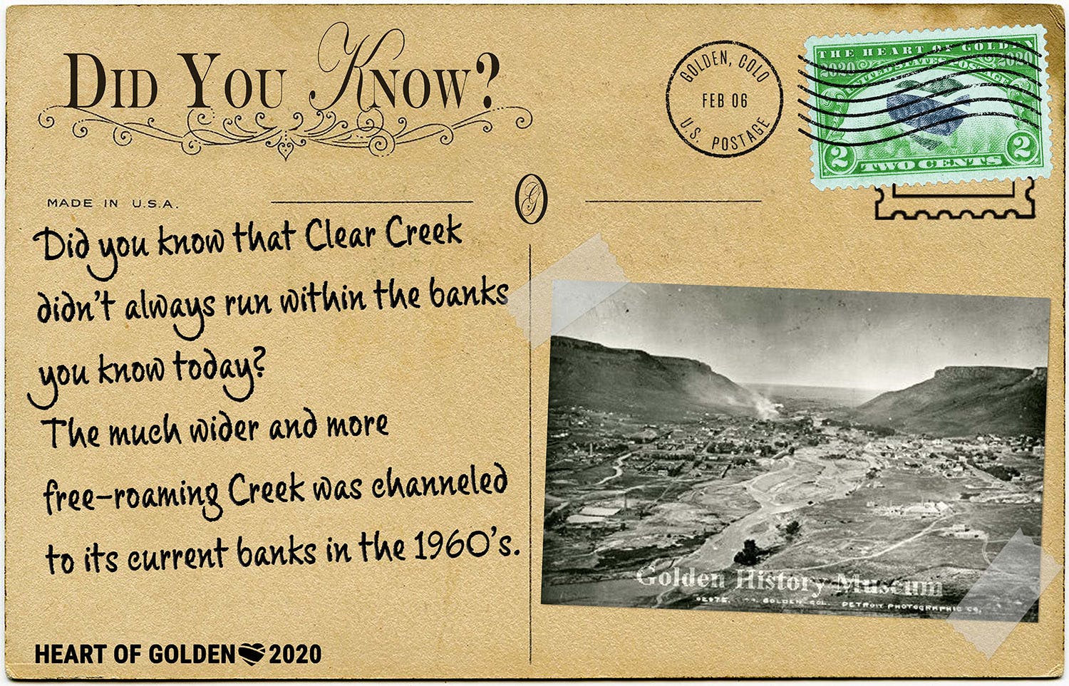
According to local historian, Richard Gardner, "When the gold rushers arrived in 1859, Clear Creek was mostly a single channel, as the first map of Golden shows. Today's City Hall would have stood on an island while today's campground would have been on the south shore of Clear Creek, not the north. Otherwise it was largely like it is now. Then the Floods of 1864 turned it into a delta west of the Avenue bridge; except upon Washington Avenue nothing was historically built there. In the 1930s it was straightened once again by Depression-era federal works projects, and by the 1960s it was configured as it is now. Portions still like their 1859 selves include the last original wild grove of trees on the shore north of Marv Kay Stadium (also the location of our first sawmill, but they didn't want cottonwoods!), the Washington Avenue and Ford Street bridges are at their original crossings first built in 1859 and 1860, the river east of Washington Avenue out to Coors is more or less like its original self, though with a far higher south bank since 1904, to prevent chronic flooding and to protect the Vanover Park tree and its descendants. Through Coors, the river was given an emergency rerouting during the Flood of 1894 to save the Coors Mansion. West of Highway 6, it's also in its original location, historically known as Jackson's Rapids."